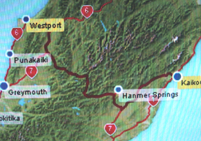
February 27 -- Kaikoura to Westport
 The drive to
Westport, on the opposite coast from Kaikoura is about 207 miles and takes
nearly 5 hours. The route crosses the mountainous spine of the South
Island, going through the Lewis Pass.
The drive to
Westport, on the opposite coast from Kaikoura is about 207 miles and takes
nearly 5 hours. The route crosses the mountainous spine of the South
Island, going through the Lewis Pass.
Westport, however, is a primary
designation for this trip, owing to its status as a sister town of our own
Westport, Mass, and the fact that it is off the beaten tourism track in the
South Island. Westport has about a third of the population of our own
Westport (~6,000 vs ~15,000), and sits at the mouth of the Buller River, one of
the largest of the west coast rivers draining to the Tasman Sea.
Historically, Westport gained a foothold as a Gold Rush city in the 1860s, and
then morphed into a coal mining center--particularly involved as a port from
which the region's coal was (and is) shipped.
A dominant feature of the town is its location near the mouth of the Buller
River. Today the Buller River is the site of interesting
white water rafting
trips. And I've booked a trip with Buller Adventure Tours. The river is
named after Sir Walter Lawry Buller (1838 -1906), who was New Zealand's most
prominent ornithologist. Buller led an interesting, and somewhat suspect
life. His
biographical sketch is worth reading.
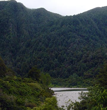
Today's drive took me from Kaikoura, on the east coast of the South Island ,
southwest to Watau and the jogged west and north across Canterbury, into the
central mountains, across Lewis Pass and on to Westport down the Buller River
Gorge.
The first part of the trip was through fairly flat country, consisting
mainly of sheep and cattle ranches, with sheep predominating. The country
sure does have a lot of sheep. The cattle are managed for meat, I've seen
almost no dairy farms. New to my experience so far was the appearance of
Red Deer and Elk ranches. Of the six or seven I passed on this trip,
the largest had thousands of these deer, enclosed on thousands of acres by high
wire fences. Red Deer originate in Europe, and are a large species, much
like our American Elk, which are also successfully ranched here..
I also noted the first rabbits I've seen--a pair of cottontails, and
two large hares that are probably the European form that was introduced into
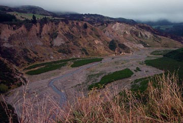
both Australia and New Zealand. Going down the Inland Road (Rte 70) I began
encountering river systems draining the mountains to the west, that produced
lots of deposition from upstream erosion. The amount of sediments carried by these
(now) shallow streams is impressive. Here is an example.
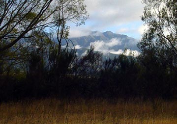
Finally, when approaching Hanmer Springs, taller forested mountains, appear
in the morning mists, giving some relief to the rolling, fairly arid
countryside.
These mountains get more impressive as you approach the central spine of the
South Island
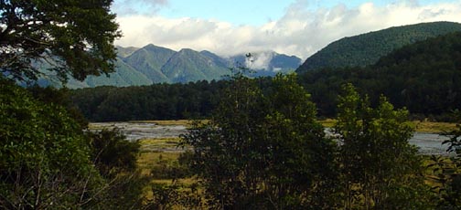
Finally, crossing Lewis Pass, the green extends right down to the road
sides, with lots of ferns and tree ferns bordering the road. The quick
running shallow streams in this region, north of Reefton, feed into the Buller River,
that flows through an impressive gorge and down to Westport.
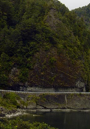
The picture above illustrates an uniqueness about New Zealand roads.
On the South Island, many of them are single lane bridges, and the traffic side
without the right of way, must stop to let oncoming traffic through. This
example is not a bridge, but a one lane road carved into the mountain side.
The hazards of driving here are enhanced! By the way, the high water mark
on this, the Buller River, is about 8 feet above the roadway on this curve!
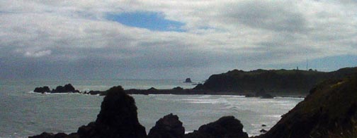
Before going into Westport, I continued down the coast for ten or twelve
miles to Cape Foulwind, to see the seal colony at Tauranga Bay, next to the
cape. While the observation deck was distant from the seals, it was still
an interesting sight.
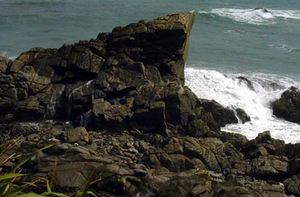
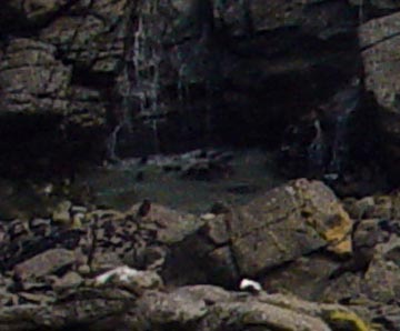
From the distance in the picture on the left, you can see a
pool under the waterfall (really waves crashing over the rocks). In
the enlargement on the right you can see the pool is filled with young New
Zealand Fur Seals, probably weighing no more than 5 kg. Their mothers are
scattered about on the rocks to the right of the left side picture.
Cape Foulwind is a forbidding site, and when I was there, the
wind was howling out of the west, and the sky was dark.
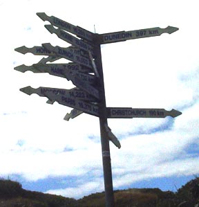
A nearby signpost attests to its distance from the civilized
world. My GPS unit tells me that this sign is just 9,278 miles from my
front door!
Driving on back up the coast to Westport, I checked into my motel and had
some time to look around the town.
Westport, New Zealand is a town with a population of about 7,000 folks, and
is the county seat of Buller County. Lying at the mouth of the Buller
River, Westport has a history of being a port city--one of the most important on
the West Coast of New Zealand. That position was solidified, first in the
1800s by the discovery of gold nearby, and later by the development of
significant coal deposits to the northeast of the town. In today's economy
coal is still mined, but is now shipped by rail to Christchurch for transpacific
shipment. The port function of the town is basically as a fishing port
that has some local fishing vessels, but also a freezer plant for a larger
company that handles the catch of offshore trawling vessels not based in
Westport.
Despite is population of half the size of Westport, Mass, the New Zealand
Westport appears to be a larger economic force, with a long broad main street (Palmerston
Street) that is lined with businesses, shops, town & county offices and motels,
much in excess of that found here. This is probably because it is the
economic hub of a region easily the size of Bristol County, Massachusetts.
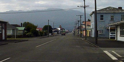 Looking up
Palmerston Street from the wharf end of town to the mountains in the background.
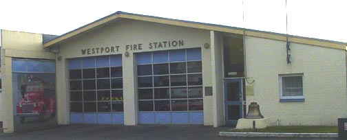
The town hall (Westport Council Chambers), County Seat (Buller Council Chambers)
are located here. Also you find the Fire Station, banks, library, many law
offices, and at least ten bars along this street. There are also many
shops, automotive and marine repair shops, as well as food and clothing stores,
and several motels. It looks like a thriving, if somewhat sea beaten town.
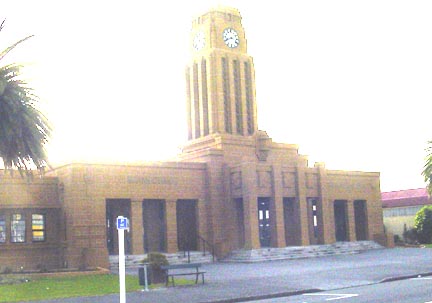
Looking up
Palmerston Street from the wharf end of town to the mountains in the background.
The town hall (Westport Council Chambers), County Seat (Buller Council Chambers)
are located here. Also you find the Fire Station, banks, library, many law
offices, and at least ten bars along this street. There are also many
shops, automotive and marine repair shops, as well as food and clothing stores,
and several motels. It looks like a thriving, if somewhat sea beaten town.
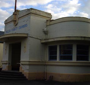
Buller County Seat (Council Chambers)
Westport Town Hall (Council Chambers
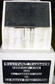 The
Westport harbour was first constructed about 1885, and there is a monument to
that occasion.
The
Westport harbour was first constructed about 1885, and there is a monument to
that occasion.
Because the Buller River empties into the Tasman Sea, the
harbor is a treacherous one, as it faces the west, and the prevailing strong
winds are the westerlies. So the combination of unrelenting winds and lots
of rainfall makes it a tricky place for boats to operate. Westport's
fishing fleet is comprised of small boats that make day trips when the weather
is not too bad.
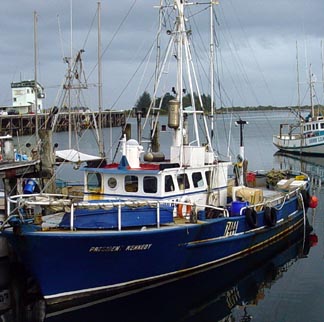
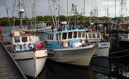
Most of the boats are rigged for multiple uses, including dragging, pot
hauling and as trollers for school tuna. For reasons I was unable to
fathom, the blue boat on the left is named, "President Kennedy."
Now, more than a year and half later (Aug. 25,
2008) the story of the naming of this boat has come to light. Lawrence de
Rijk sent me an email, reporting that, "This
vessel was built at Bluff by my Father Mr Cornelis de Rijk. He laid the keel on
the day JFK was shot, for this the choice of name." I find this very
satisfying.
Tomorrow I'll try the white water rafting on the Buller River